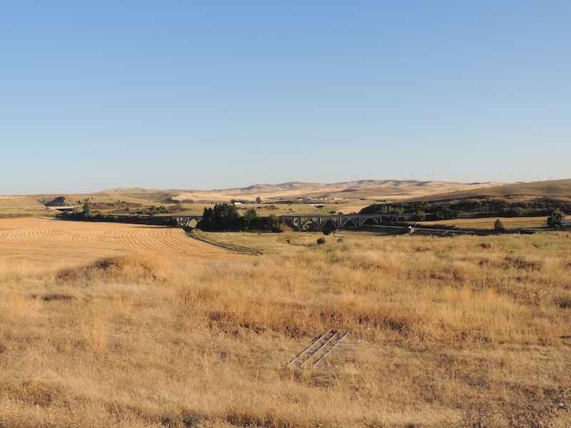
The Steptoe Defeat, 1858
Steptoe's foray into Coeur d'Alene Indian lands in the spring of 1858 led to the Wright Campaign against these people later in the year.
Text
Virginia native Edward Jenner Steptoe graduated from West Point in 1837. His first military service was in Florida against the Seminole Indians. He also fought in the Mexican War. In 1854 he became commander of Fort Walla Walla in Washington Territory.
This was a difficult time in the Pacific Northwest as white settlers had been arriving on the Oregon Trail. As Natives steadily lost land to these migrants, tensions mount ted.
Adding to this, gold discoveries in British Columbia and north-central Washington Territory caused miners to flood across lands that treaties had promised to the Indians. The Walla Walla Treaty of 1855 forbade whites from trespassing on Indian lands unless the Natives invited them. but by 1858 this treaty had not yet been ratified by Congress and many white people did not abide by it.
Colonel Steptoe's correspondence of the week before the battle reveals that he intended to march to Colville and mediate a dispute between Indians and white miners.
The command of 150 men and an attendant train of mules and equipment departed Fort Walla Walla on May 6, 1858. They had two mountain howitzers but Steptoe ordered the men to leave their swords at the fort. After ten days of travel, they forded the Snake River at Red Wolf's Crossing.
Local tribes regularly camped together at this time of year, to gather camas root while it was blooming. And because the soldiers seemed to be heading toward a gathering of women and children out gathering this root, the Indians became suspicious of their intent.
On the 16th of May, 1858, after crossing the Snake River, Steptoe and his soldiers came upon Indian warriors from several bands, who chastised them and told them that they should not be on Indian land.
The Soldiers continued and on the 17th drew near Stubblefield Lake, where Native women and children were gathering spring roots. Distraught, the Indians sent messengers on horseback around Lake Coeur d'Alene to spread the word and gather warriors to defend their people and land.
The Jesuit Father Joset heard what was happening and hurried to the location in an attempt to prevent violence and after a meeting with Joset and the Coeur d'Alene Indian leader Vincent and others, Steptoe determined to turn back to Fort Walla Walla. but as they began to turn, a shot rang out from the back of the train, and an Indian man was killed. This enraged the Indians, who began to fight back and a running battle ensued.
The warriors and the soldiers fought from hilltop to hilltop all day long, heading south from the Stubblefield Lake area to what is now the town of Rosalia where the soldiers began to run low on ammunition.
Desperate, and as darkness fell, they made a stand on the top of a plateau and picketed their mules and horses in a circle with the gear and soldiers on the inside. Indians of different tribes surrounded them on all sides.
In spite of this, almost miraculously, the troops escaped in the middle of the night. They left all their equipment and mules they buried their dead and the howitzers.
The soldiers had a large amount of whiskey with them and while getting ready to escape in the night, Sergeant Ball was charged with discarding the whiskey which he did. Drunk, he made his way to Pine Creek where he passed out under a bush. When he woke in the morning, he found that the troops were gone and It took him nearly two weeks to walk back to Fort Walla Walla.
Some have judged it unlikely that Steptoe and 150 men could escape in the middle of the night with no ammunition and completely encircled by Indians. There are differing stories telling how this happened. The soldiers say that they were stealthy and tricked the Indians and the Coeur d'Alene Indians say that they let the soldiers through their side of the surround to prevent greater violence.
As a result of this embarrassing defeat, Colonel Steptoe was placed on sick leave until he resigned his commission in 1861. He died four years later in Virginia, at the age of forty-nine.
This battle is also called The Battle of Pine Creek, The Coeur d'Alene word is "Hngossemen," and the Nez Perce word is Tohotonimme."
Files
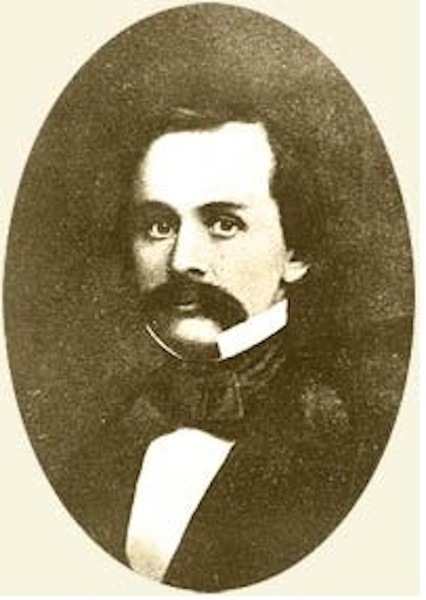
Image of Colonel Edward J. Steptoe
This is an image of Colonel Edward Jenner Steptoe (November 7, 1815 - April 1, 1865). He was born in Virginia, and graduated from West Point. As an Army soldier, he saw engagements in the War against the Seminole Indians in Florida, the Mexican-American War, and the War against the Northern Indians in Washington Territory in 1858. image source: B. F. Manning, The conquest of the Coeur d'Alenes, Spokanes and Palouses : the expeditions of Colonels E.J. Steptoe and George Wright against the "Northern Indians" in 1858 Spokane, Wash. : Printed by Inland Print. Co. 1912.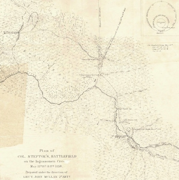
Plan of Col. Steptoe's, Battlefield on the Ingossomen Creek, May 15th, 16th, & 17th, 1858
This is visual of the map that was made when Colonel Wright was on his way to what would become the Battle of Four Lakes. Lieutenant John Mullan, 2nd Arty. was dispatched together with his men, including Theodore Kolecki, who prepared this map. Plan of Col. Steptoe's, Battlefield on the Ingossomen Creek, May 15th, 16th, & 17th, 1858 They were also to recover any bodies and the Howitzers. Source, Washington Secretary of State, Digital Archives, Washington State Library. [electronic resource] http://www.sos.wa.gov/history/maps_detail.aspx?m=72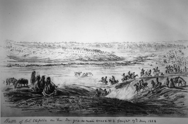
Battle of Col. Steptoe on the In-Gos-Se-Man Creek, W.J. Fought 17th of May, 1858. (Courtesy National Parks Service)
Image by Gustavus Sohon of the Steptoe Defeat. This was drawn when John Mullan was dispatched to the site during Colonel George Wrights march north toward the Battle of Four Lakes. This image is interesting in that it is drawn from the vantage point of the Indians. You can see the troops in a circle on the far hill, where the high school football field is now located. It is interesting that Sohon uses the Coeur d'Alene word for the creek, "Hngossemen" which Cliff SiJohn says means the place to gather materials for making ropes. Source: Image courtesy of National Park Service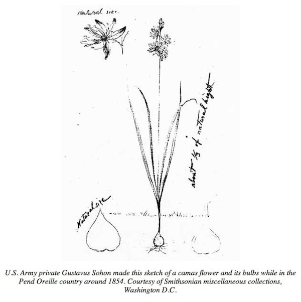
Camas Plant, drawn by Gustavus Sohon, 1854.
Camas is a relative of the hyacinth and a traditional food for the native peoples of this area. A group of Indians were digging Camas root, as they did each year in the spring, when Steptoe came upon them. Image drawn by Gustav Sohon and Courtesy of the Smithsonian Institute.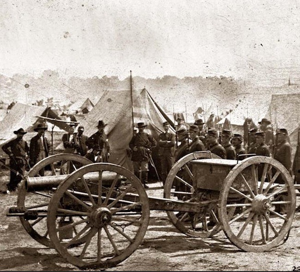
12 lb. Howitzer
Colonel Steptoe had two howitzers along with him on his foray into the Coeur d'Alene Indian territory. This greatly added to their distrust of his intentions.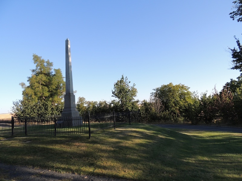
Monument to the Steptoe Battlefield, put up by the Esther Reed Chapter of the Daughters of the American Revolution, 1914.
Erected 56 years after the battle that it honors, this monument is interesting because it celebrates the history of the victors. Although the allied Indian nations won the battle that it commemorates, the larger war was lost. The only Indian casualties or achievements honored here are those who fought with Steptoe, the Nez Perce. There are engravings on three sides of this obelisk. On one, is stated, "In memory of Chief Tam mu tsa (Timothy), and the Nez Perces Christian Indians, rescuers of the Steptoe Expedition." These Indians are memorialized, because they were on the side of the victors and were feuding with those Steptoe fought against. There is no mention here of the reasons for the conflict, or that Colonel Steptoe had no legal right to be on Coeur d'Alene land, which this was at the time. Another side states, "Killed in conflict, Capt. O.H.P. Taylor, Lieut. William Gaston, Sargt. Wm. C. Williams, Alfred Barnes, Victor Chas. DeMoy, James Grozet, Charles H. Harnish, All of the first dragoons, United States Army." Photo: Lea Anne Scott 9/12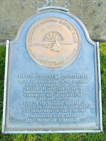
Steptoe Battlefield Monument plaque
This plaque is on the fourth side of the monument, it was placed by the National Parks Service in 1976. The stated Indian name of the battle as "Tohotonimme," which is a Nez Perce word. The Coeur d'Alene word is "Hngossemen," which means "place were we make rope." Photo: Lea Anne Scott. 9/12