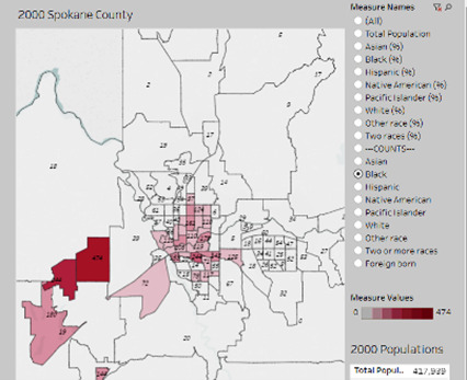
Spokane County Census Map 2000
This file appears in: The Origins of Segregated Neighborhoods in Spokane
The Spokane County census map from 2000 on the University of Washington’s website showcases exactly where African Americans in Spokane were living at the time. The map illustrates exactly how many blacks resided in each district of the county. The aftermath of redlining and changes in Spokane’s demographics over time are highlighted.
This file appears in: The Origins of Segregated Neighborhoods in Spokane
The Origins of Segregated Neighborhoods in Spokane
Discrimination and segregation were common in Spokane much of the early-mid 20th Century. Segregated neighborhoods and even cemeteries existed as early as the 1920s. De jure segregation (government sponsored) supported racially restrictive property…
